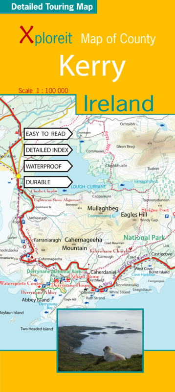


Fietskaart - Wegenkaart Kerry (Ierland) | Xploreit | 1:100.000 | ISBN 9780955265518
Mooi uitgevoerde geplastificeerde en scheurvaste kaart van de County Kerry met index. Door de schaal van 1:100.000 prima te gebruiken als fietskaart en als wegenkaart. Ook een goede kaart om een overzicht van de wandelroutes in de regio te krijgen. Niet een wandelkaart als zodanig !
The Xploreit Map of County Kerry includes all of the 'Kingdom' of Kerry along with parts of counties Clare, Limerick and a large part of County Cork. Famous tourist destinations such as Killarney National Park, the Dingle Peninsula, the Skellig Islands (a UNESCO listed World Heritage Site), Derrynane House and the 'Ring of Kerry' scenic route are all shown on one double-sided map sheet. Several scenic drives, cycle routes and waymarked walks are shown. The scale of the Kerry map is 1:100,000.
Walking Routes
It has been possible to include all the national waymarked ways in Kerry and many of the routes in Cork. The ways covered are listed below:
- The Dingle Way
- The Kerry Way
- The North Kerry Way
- The Beara Way
- The Sheep's Head Way
- The Blackwater Way (partly shown)
Cycling Routes
All the Kerry cycling routes are shown and many of the routes in Cork are also included:
- The North Kerry Cycle Route including the Fenit and Kerry Head loops
- The Ring of Kerry Cycle Route
- The Beara Cycle Route
- The Sheep's Head Cycle Route
- The Gougane Barra Cycle Route (from Ballylickey to Macroom)
(ISBN: 9780955265518, 1:100.000)
fietskaart ierland, fietskaart kerry, wegenkaart ierland
Combineer dit artikel met
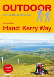 Wandelgids Kerry Way | Conrad Stein Verlag | ISBN 9783866865549
(ISBN: 9783866867871, 2022, 160 pagina's)
Conrad Stein Verlag is een Duitse uitgever met een ruim assortiment compacte wandel-, (en in beperkter mate) fiets- en reisgidsen naar bestemmingen die wat minder vaak worden…€ 15,90


boekwinkels zitten er bij mij in de buurt ?")