

Fietskaart North Cumbria & Dumfries | Sustrans Cycle Map 35 | ISBN 9781910845158
Deze kaart geeft de National Cycle Network en de aanbevolen fietsroutes door dit gedeelte van Engeland en Wales. Alle fietsroutes in betreffend gebied staan keurig ingetekend, dus ook die van het National Cycle Network. Ook veel praktisch zaken als bezienswaardigheden, stations, supermarkten, fietsenmakers, pubs, hotels etc. Bovendien zijn er vier dagfietstochten op de kaart vermeld.
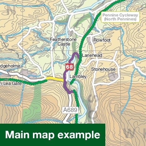
This area map shows the National Cycle Network and local routes in this area. It covers North Cumbria region in North England and Dumfries region in Scotland including: Carlisle, Dumfries, Gretna and Annan.
This pocket-sized colour map shows clearly mapped on-road and traffic-free paths, easy to read contours, and detailed inset maps for the major towns and cities as well as recommended linking routes connecting the NCN with quiet roads. The map also features 4 day rides with directions and a description of the area, highlighting key cycle routes and places of interest.
Major cycle routes covered by this map:
- National Route 7 between Raughton Head and Dumfries. This is the start of the Lochs and Glens South cycle tour.
- National Route 10 between Westlinton and Kielder Water. This is the western half of the long-distance cycle tour Reivers Route.
- National Route 68 between Alston and Wark Forest. Know as the Pennine Cycleway.
- National Route 72 between Silloth and Haltwhistle. This makes up part of the long-distance cycle tour Hadrian’s Cycleway.
- National Route 74 between Gretna and north of Moffat.
- Regional Route 10 through the Forest of Ae.
(ISBN: 9781910845158, 2016, 1:110.000 )


boekwinkels zitten er bij mij in de buurt ?")