

Landkaart Greenland - Noordpool | ITMB | ISBN 9781771293228
(ISBN: 9781771293228, 1:1,5 miljoen)
Groenland en Noordpool wegenkaart 1:3.000.000 / 1:9.000.000
Landkaart van Groenland schaal 1:3.000.000 en het Noordpoolgebied (Arctica) ten noorden van 60' noorderbreedte op schaal 1:9.000.000.
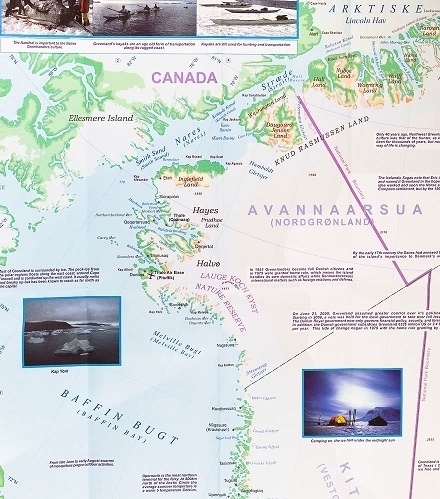
A map from with physical colouring of its coastal areas and on the reverse the North Circumpolar Region at 1:9,000,000, centered on the North Pole, on a political map showing the countries around the Arctic Ocean.
The map of Greenland has elevation colouring for the coastal areas, with spot heights also shown in the interior. Main settlements are marked and the map shows local airfields and heliports, as well as ferry connections along the south-western coastline. The map is indexed and has latitude and longitude lines at intervals of 3° and 6° respectively. Also included are notes on various aspects of Greenland’s history, geography, climate, places of interest etc.
On the reverse is a political map of the Arctic Sea and the North Circumpolar Region from Natural Resources Canada, the country’s topographic survey organization. The map covers an area north of 55º of latitude, with countries presented in different colours against the surrounding seas which have bathymetric colouring. Relief shading shows the terrain on land and the sea bed, where ridges and basin are named. Glaciated areas are indicated and the map shows both the limit of permanent polar sea ice (from 1972 to 2007) and the tree line on land. Latitude lines are drawn at intervals of 5º, with longitude at 10º.


boekwinkels zitten er bij mij in de buurt ?")